![]()

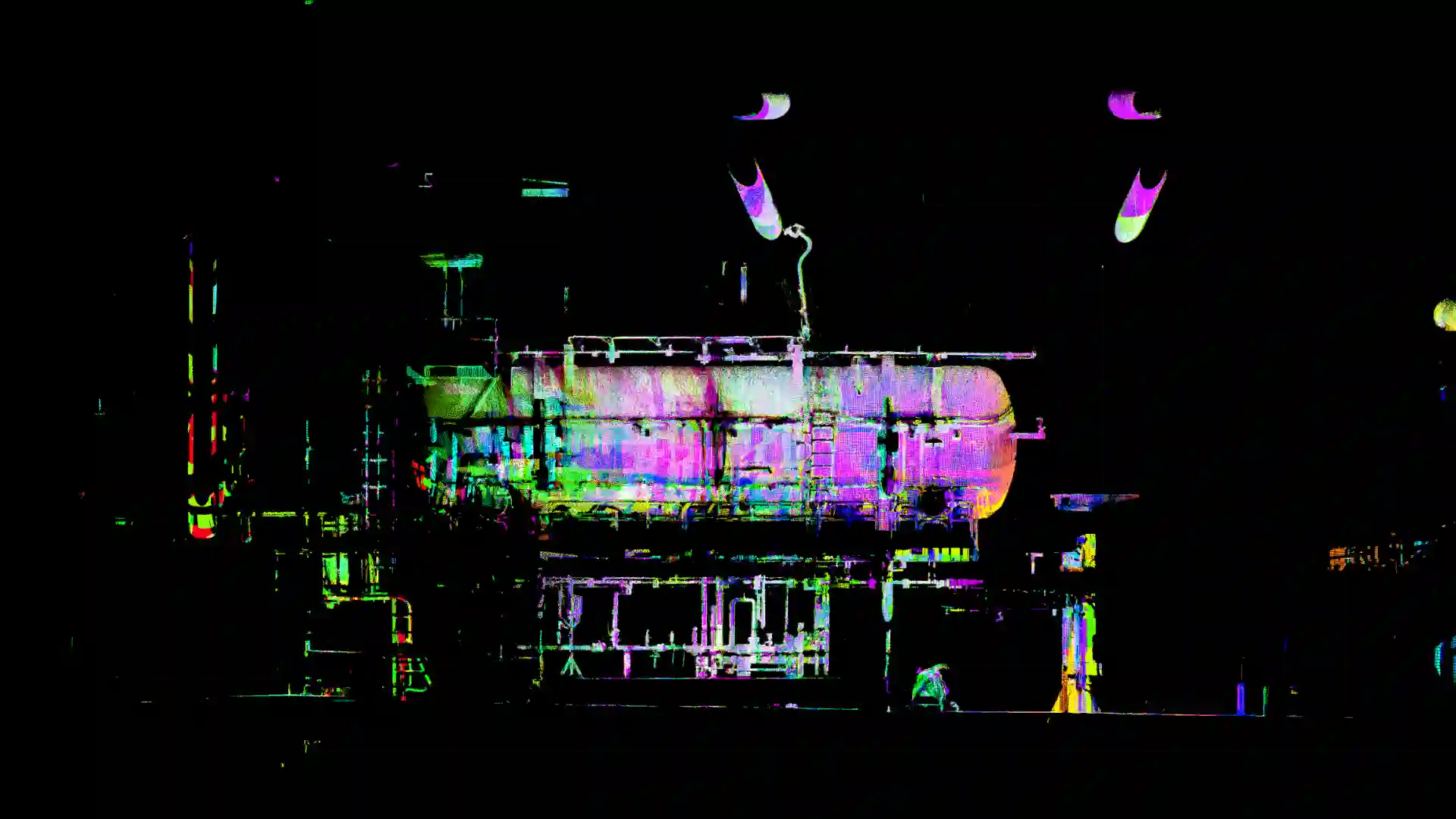
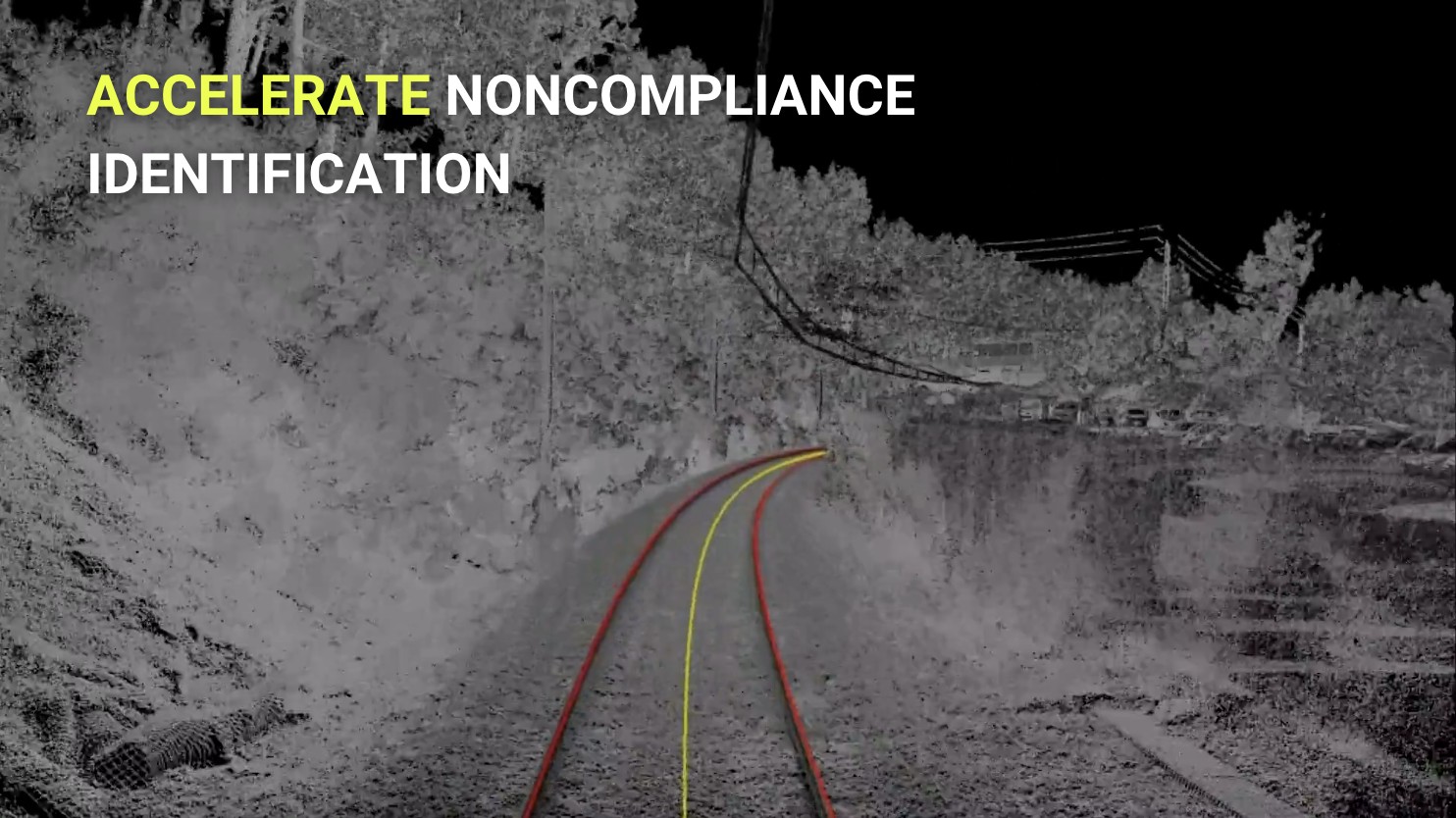
Problem
Checking the quality and conformity of each point cloud manually is time-consuming and prone to human error.

Solution
Development of custom automated software capable of checking the conformity of thousands of scans.

Results
Analysis report of all scans not meeting compliance fields.

ROI
2x cheaper, 10x faster, 100% reliable

![]()
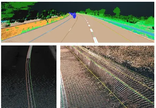
The Marseille - Ventimiglia railway line, a strategic axis of cross-border mobility, presented major technical challenges. Until now, the track geometry was carried out manually, an extremely time-consuming and unsustainable method to meet the deadlines set by the ERTMS project. Furthermore, this analysis requires specific savoir-faire from railway track experts, who are rarely available.
Analyzing, modeling and validating the plan axis and the longitudinal profiles required months, even years of work, delaying critical decision-making and increasing costs.
It is in this context of technical and technological challenge that TheCrossProduct has developed an innovative automated software to analyze the geometry of railway track axis, capable of generating precise models of horizontal and vertical alignments in both plan and profile views in just a few minutes. Thanks to this cutting-edge technology, the complete layout of the Cannes-Grasse line, pilot line of the HPMV (High Performance Marseille Vintimille) project, was able to be modeled quickly, providing files in the standardized LandXML format. An exceptional time saving: Where previously several weeks of manual work were required, TheCrossProduct's solution performs the same task in a few minutes.
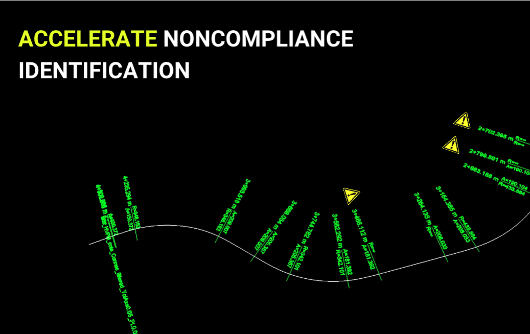
This solution not only reproduces the railway layout: it also allows for the instant identification of existing non-conformities and defects. Engineers can thus analyse the data at a glance, significantly reducing diagnostic and intervention times.
SNCF Réseau is more than won over by the results obtained. Thanks to TheCrossProduct, it has a strategic tool to achieve its modernization and compliance objectives. The collaboration has been a real success, consolidating a relationship of trust and paving the way for new innovative projects...
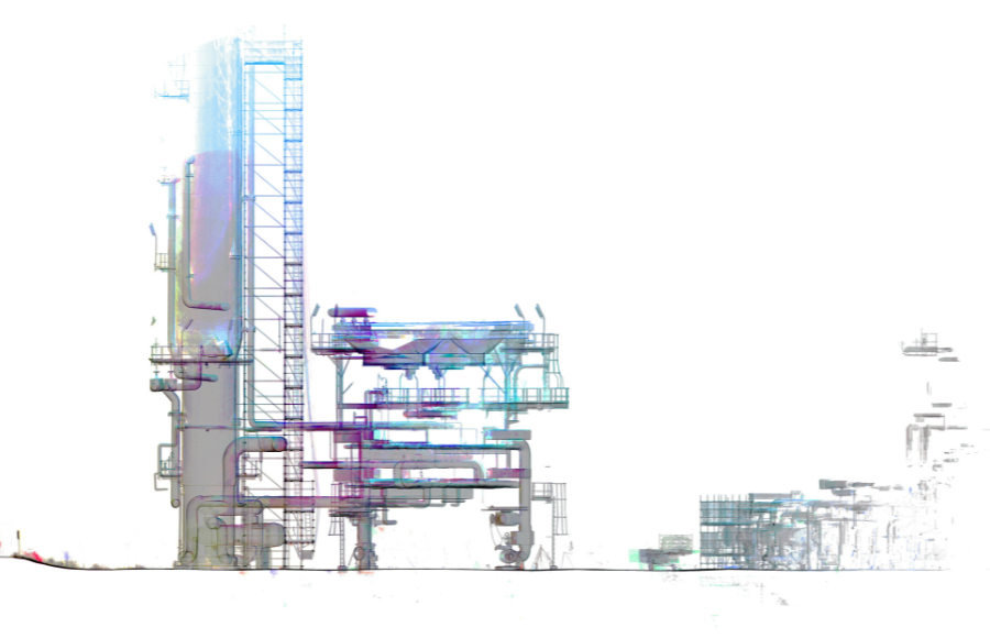
Problem
Rediscover the railway track geometry analysis of hundreds of kilometers
Solution
Development of automated track geometry analysis software, plan axis and longitudinal profile generated in a few minutes.
Results
Plan axis and longitudinal profiles in standardized LandXML format.
ROI
Projects of hundreds of km achievable, 100x faster, precision of results
![]()

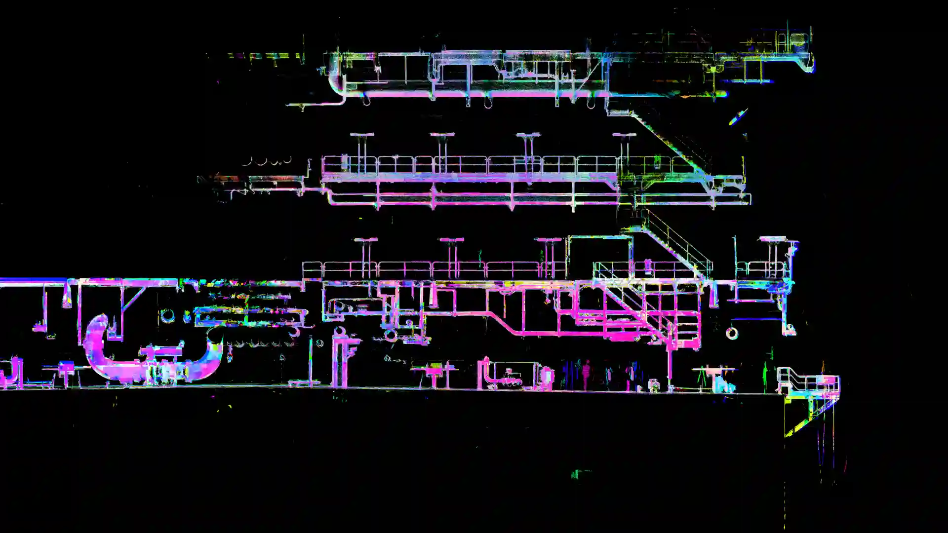
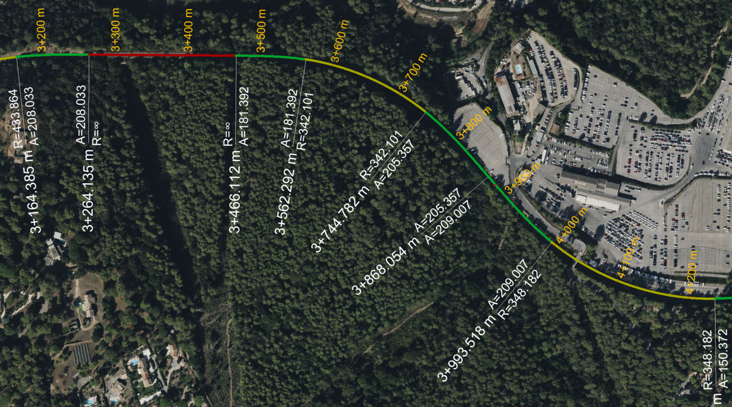
Problem
Traditional methods are unsuitable for the geometric study of large road networks because they are time-consuming, subject to human error, and inapplicable to large-scale projects.
Solution
Our automated software is capable of performing massive data analysis with precision. Combined with the business expertise of an engineering company, our software offers a turnkey solution to highway concessionaires for fast and informed decision-making.
Results
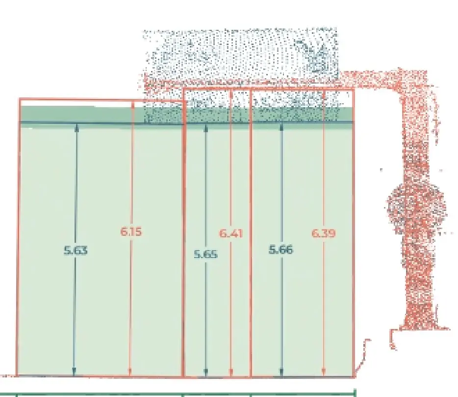
Measurements, 3D modeling, template studies, reverse engineering, conformity analyses, recommendations, etc.
ROI
Large-scale analysis, time saving (10x faster), higher accuracy (x10 more accurate)
![]()
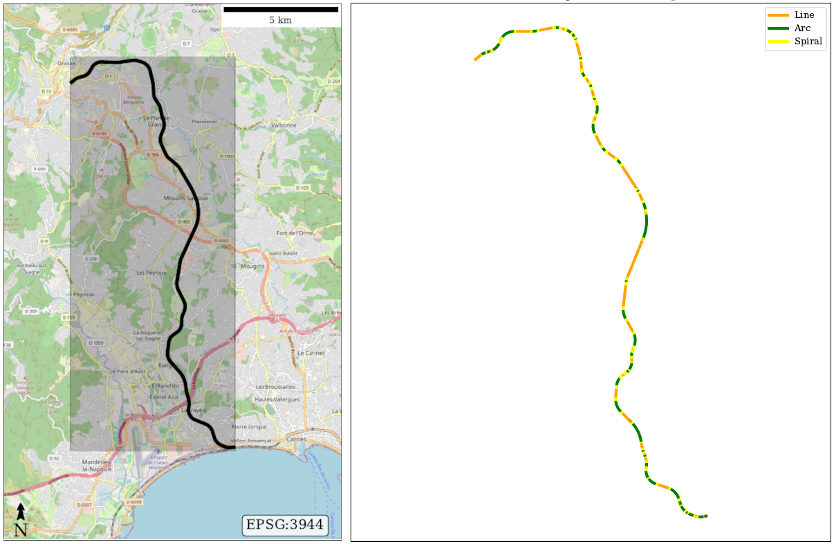
Problem
Manual reverse engineering of thousands of kilometers of roads in Spain. Time consuming and prone to human error.
Solution
TCP's automated reverse engineering solution, capable of processing massive data accurately and in minutes.
Results
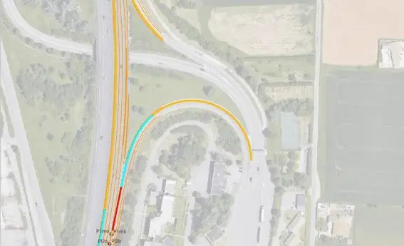
Road geometry, plan axis and longitudinal profile generated in minutes...
ROI
Save time and get accurate results
Want a demo?