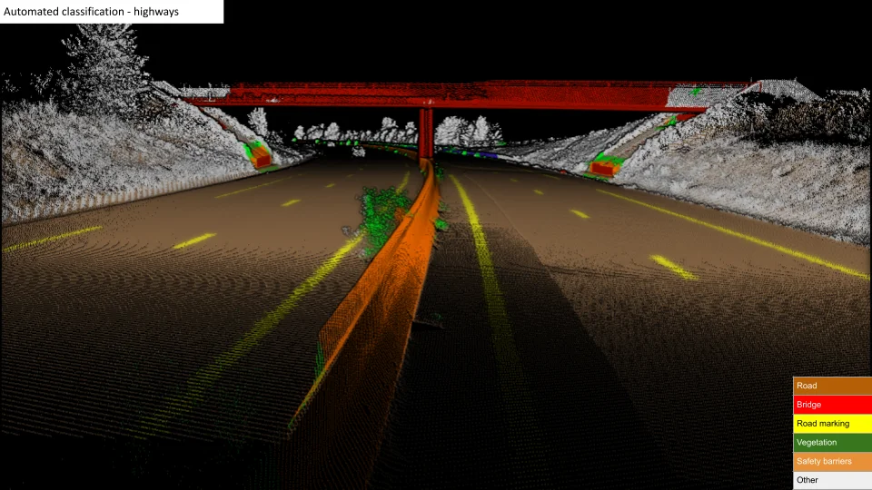
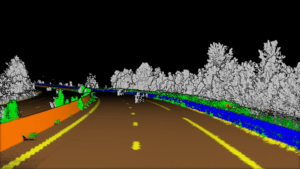
With our software, each object gets assigned to a category to allow an extensive and accurate analysis of detection, inspection and inventory.

Our solution is fully automated, reliable and fast to meet the needs of predictive and corrective maintenance.
An algorithm that is capable of processing sections individually in order to obtain a global view of the network.

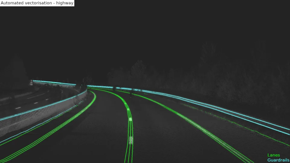
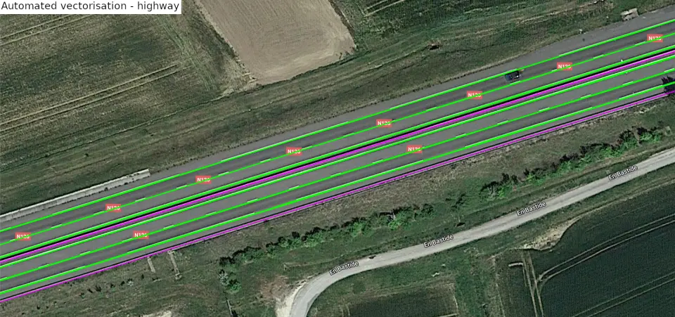
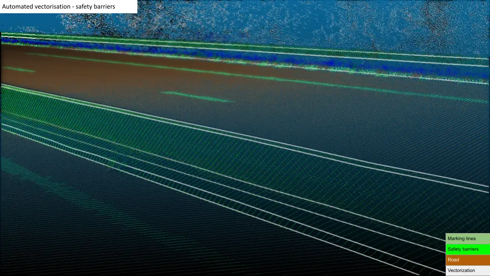
The analysis of polylines to study the geometry of each linear element.
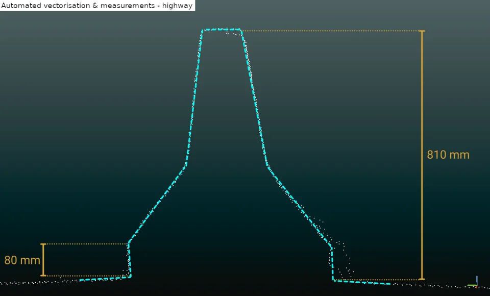
![]() This enables the automation of measurements as slope, radius of curvature, lane width, lane tilt, safety barrier height,...
This enables the automation of measurements as slope, radius of curvature, lane width, lane tilt, safety barrier height,...
The vectorized elements can be transferred to utilize a Geographic Information System (GIS) or Building Information Model (BIM) application.
Our solution is fully automated, reliable and fast to meet the needs of predictive and corrective maintenance.
An algorithm that is capable of processing sections individually in order to obtain a global view of the network.

The identification of risks due to an extensive analysis of infrastructure geometry.
The optimization of preventive maintenance and scheduled interventions.
The automation of measurements such as radius of curvature, lanes tilt, lanes width, safety barriers height,...
Our solution is fully automated, reliable and fast to meet the needs of predictive and corrective maintenance.
An algorithm that is capable of processing sections individually in order to obtain a global view of the network.


Want a demo?
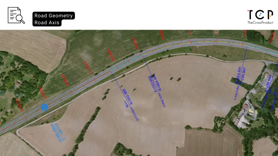
 Since 2015, the use of GIS, BIM and even BIM connected to GIS has been carried out at setec according to needs and uses, with the most sober approach possible and avoiding multiplying technologies. An example is the use of mobile mapping for highway reverse engineering, in collaboration with
 ![]()
One step closer towards digital twins!
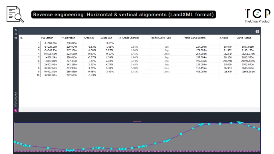
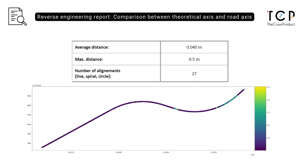
 Geograma is a company specialized in asset inventory, having travelled over 200,000 km of roads to inventory road assets. Sometimes we are asked to find the geometry of the axis of the road, that is, to carry out the reverse engineering process to find out, from Mobile Mapping data, both the state of alignments made up of straight lines, clothoids and curves as well as the longitudinal vertical plane. With TCP algorithms integrated into the GeoCassini platform, manual processes that used to take weeks are now carried out in a matter of hours, allowing us to tackle large-scale projects with high-quality results.