Our solutions working together
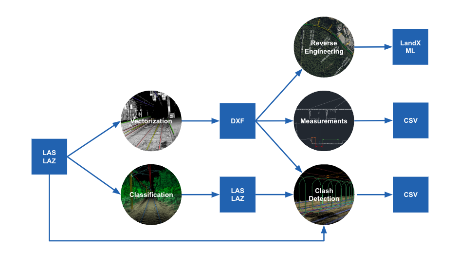


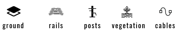
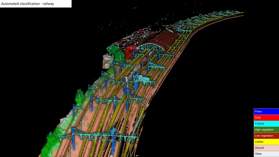
Classify raw LiDAR point clouds of railway environment. Classified point clouds will help you to extract and exploit all the precious information of your data.
With our software, each object gets assigned to a category to allow an extensive and accurate analysis of detection, inspection and inventory.

We provide an algorithm that is capable of processing sections individually to obtain a global view of the network.
Our solution is fully automated, reliable and fast to meet the needs of predictive and corrective maintenance.
Our software handles several point cloud formats such as LAS, LAZ, e57,... It is usable through different platforms or via our API.
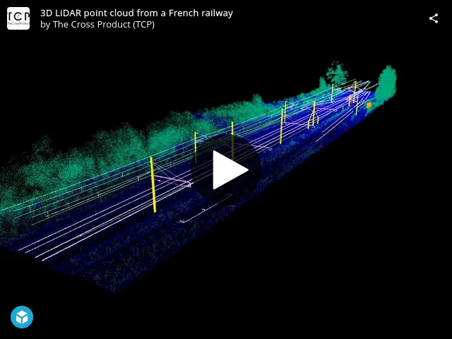
Classified 3D LiDAR point cloud from a French railway
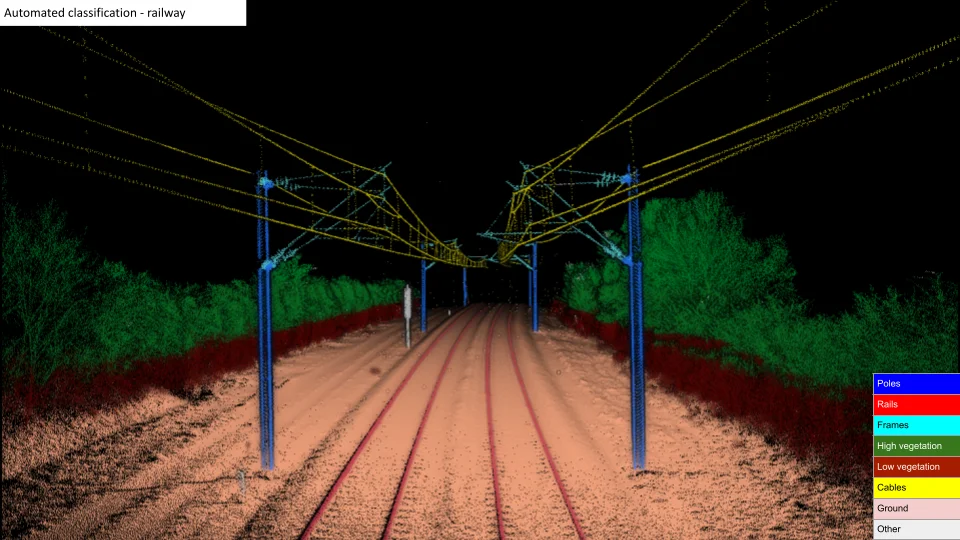
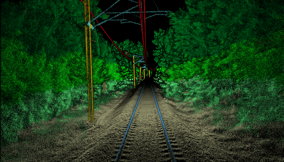

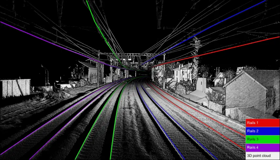
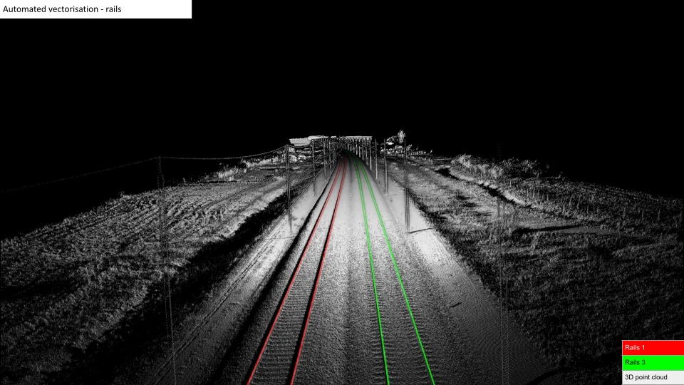
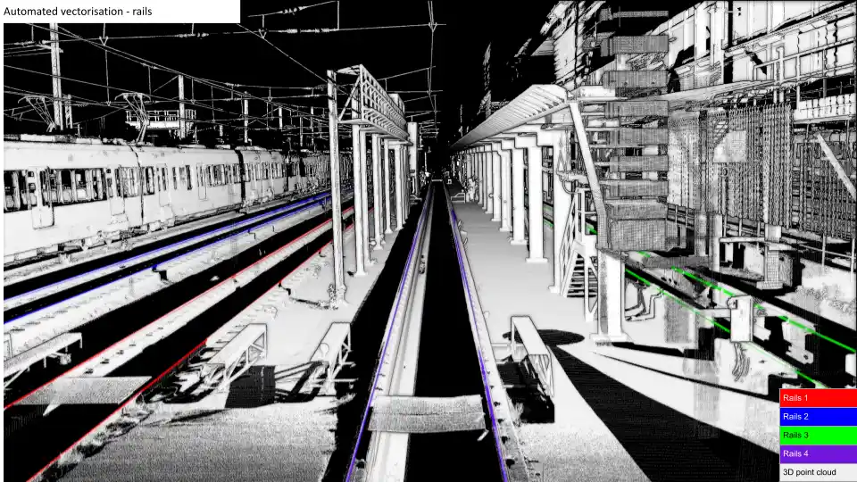
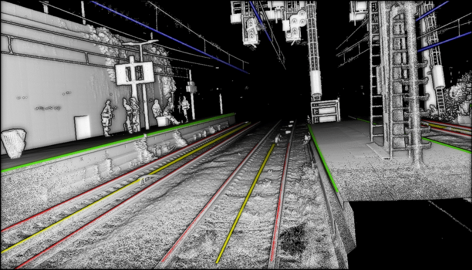
This algorithm combines artificial intelligence and professional knowledge to accurately recognize rails, track axis, contact cables, and their positions in 3D space.
The vectorized rails are exported as 3D polylines placed on the top of the rail head to study the geometry and the evolution of rails and contact cables.
This enables the automation of measurements as slope, tilt, spacing, radius of curvature, track axis shape, …
The vectorized components can be used in a Geographic Information System (GIS) or a Building Information Model (BIM) software.
To cater to the demands of both predictive and corrective maintenance, our solution is prompt, dependable, and completely automated.
Our software handles several point cloud formats such as LAS, LAZ, e57 and DXF or SHP for the polylines.
Our solution can be utilized either through various platforms or by integrating with our API.

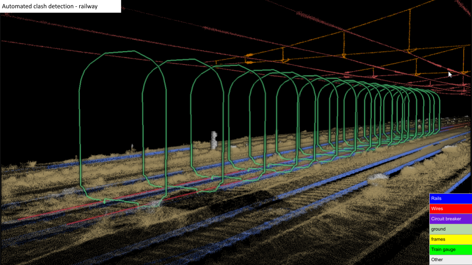
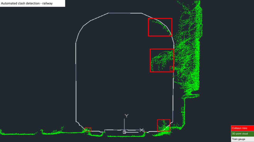
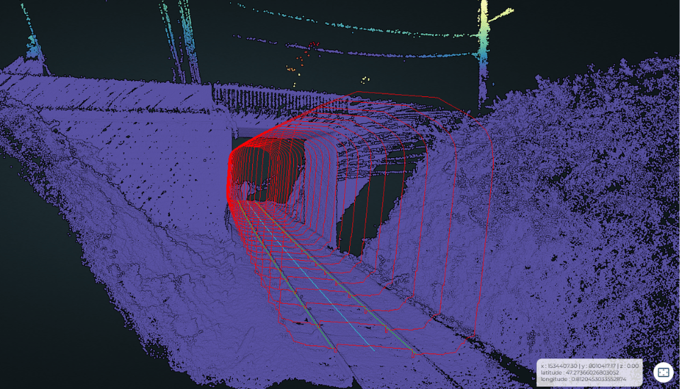
The verification with safety distances allows to detect collision risks between a virtual gauge and its environment.
Our dynamic simulation includes parameters as horizontal and vertical radius of curvature, track tilt, train speed, …
We provide an algorithm that is capable of processing point clouds of a whole network thanks to distributed computing : hundreds or thousands of km is not a problem.
Therefore, it offers the opportunity to prevent maintenance and optimize scheduled interventions.
Our solution is completely automated, dependable, and swift to meet the requirements of predictive and corrective maintenance.
.webp?width=960&height=534&name=New-clash-visuels-tranparence%20(1).webp)

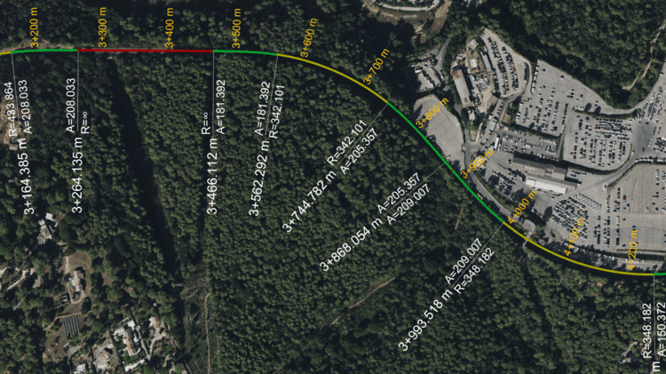
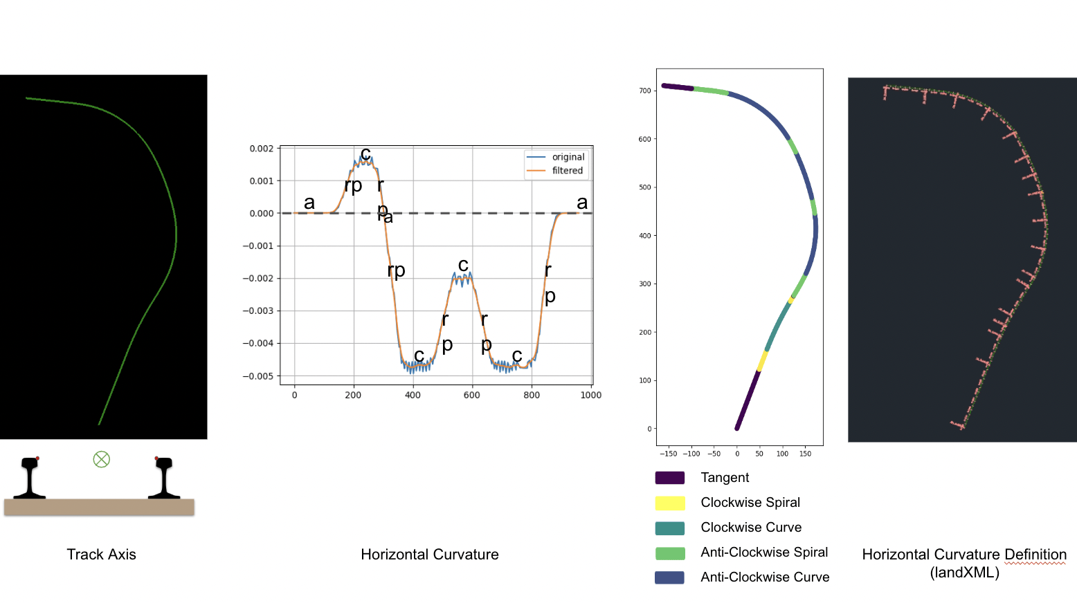
Precisely analyze the condition of the railway infrastructure thanks to automated calculations of slope, curvature, mid-chord offset and superelevation.
The algorithm performs automated calculations to retrieve the horizontal and vertical curvature definitions : track geometry in both the horizontal plane and the longitudinal vertical plane. The geometric elements, namely tangents, curves and spirals.
We provide an algorithm that is capable of processing a whole network thanks to distributed computing : hundreds or thousands of km is not a problem.
Our solution is 100% automated, reliable and fast to meet the needs of predictive and corrective maintenance.

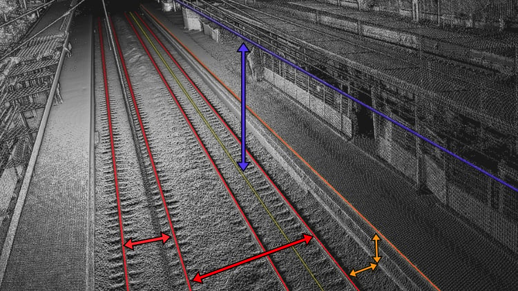
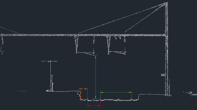
Precisely and automatically measure different distances on a railway infrastructure thanks to the TCP solution.
Our software carries out automated measurements using the 3D polylines of the rails, the axis of the track, the edge of the platform and the catenary allowing the various measurements to be automatically carried out on the 3D point cloud such as:
- 3D position of track axis (center line)
- Track gauge
- Rails add cant (superelevation)
- Twist and Wrap Warp
- Horizontal mid-chord offset over 20 m
- Vertical mid-chord offset over 20 m
- Vertical slope
- Distance from running rail to platform edge (platform gauging)
- Distance from center line to platform edge (platform gauging)
- Distance to closest track axis (track center to track center)
- Overhead (contact) wire height and stagger

Want a demo?
 By combining the professional expertise of setec, and the technical skills of
 ![]() , we have worked on an algorithm studying railway gauges, and identifying automatically the obstacles to the circulation. Through the launch of the platform Setec Capture, all companies are encouraged to invent new services based on the automation of tasks involving visual data.
, we have worked on an algorithm studying railway gauges, and identifying automatically the obstacles to the circulation. Through the launch of the platform Setec Capture, all companies are encouraged to invent new services based on the automation of tasks involving visual data.
 Technological advances have made point clouds more accessible thanks to the falling costs of LiDAR and the rise of photogrammetry. With the exponential growth of this data, setec's business expertise finds an efficient and rapid solution thanks to TCP. Automated processing capabilities offer new perspectives in production monitoring, the creation of digital twins and more generally in the field of reverse engineering. Thanks to this collaboration, our company benefits from the latest advances in the management and exploitation of this complex data, propelling our projects into the future with confidence!